Can Google Maps Be Used for Truck Routing?

For efficient and specialized delivery routing, explore how Circuit for Teams complements your navigation needs.
In the world of truck driving and delivery logistics, the importance of a reliable navigation app cannot be overstated. These specialized apps give directions and critical information about routes that are safe and accessible for larger vehicles.
With the right app, drivers can avoid common pitfalls like low bridges, weight-restricted roads, and routes with height limitations for timely and efficient deliveries.
Among the myriad of navigation tools available, Google Maps stands out as a popular choice. Known for its user-friendly interface and widespread accessibility, Google Maps offers a range of features beneficial for general navigation.
However, when it comes to truck routing, there are specific considerations to keep in mind. This article delves into whether Google Maps is equipped to meet the unique demands of truck drivers and how it compares with other tools designed specifically for this purpose, such as Circuit for Teams.
Key takeaways
- Actively explore and test truck-specific navigation apps that address the limitations of Google Maps, focusing on features like height and weight restriction guidance.
- Choose navigation apps that offer real-time traffic updates and allow route customization based on your truck's size and load, enhancing safety and efficiency on the road.
- Make sure your navigation app includes offline map capabilities to maintain constant route guidance, even in areas with poor or no internet connectivity.
- When selecting a GPS app, weigh its cost against the features it offers and verify it's compatible with your device and meets your specific trucking requirements.
Understanding the needs of truck drivers
The world of truck driving is distinct from regular commuting, especially when it comes to routing. Understanding these unique needs is crucial in evaluating the effectiveness of any navigation tool, including Google Maps, for truck drivers.
First and foremost, truck routes need to be meticulously planned. Unlike standard vehicles, trucks cannot navigate through all roads due to their size and weight.
This necessitates a navigation system that incorporates truck-specific restrictions, such as height and weight limitations, and routes that are legally designated for larger vehicles. Not adhering to these restrictions can lead to logistical nightmares and legal and safety issues.
Another critical aspect is the need for real-time traffic updates. Trucks, often operating on tight schedules, require current information on traffic conditions to avoid delays. Congestion, accidents, or construction work can significantly impact travel times, and being able to reroute on the fly is an indispensable feature for any truck navigation tool.
Additionally, information about road closures is vital. A road closure can disrupt a truck's planned route more severely than it would a regular vehicle, as finding an alternative path that accommodates a truck's requirements can be challenging.
Lastly, knowledge about toll roads is also essential. For cost-efficient route planning, truck drivers and their dispatchers need to know toll roads locations and their costs.
These elements — truck-specific routes, real-time traffic updates, road closures, and toll road information — are the backbone of an effective truck navigation system. Any app for truck drivers must comprehensively address these needs.
Google Maps for truck navigation

Google Maps, known for its comprehensive coverage and ease of use, offers several features for general navigation. However, when it comes to truck navigation, its functionality needs a closer evaluation.
Functionality for truck drivers
Google Maps is a robust route planner that’s highly effective for standard vehicles. While it offers real-time traffic updates and rerouting options, it lacks specific features tailored for large commercial vehicles.
Unlike dedicated truck GPS apps, Google Maps does not give truck-specific route guidance for truck drivers, such as avoiding roads with weight limits or low bridges.
Comparison with dedicated truck GPS apps
When compared to dedicated truck GPS apps, Google Maps falls short. Specialized truck navigation apps are designed with truckers in mind, offering features like custom routing based on the size and weight of the vehicle, alerts for truck-specific road restrictions, and dedicated truck parking spots.
These apps often include detailed information about toll roads specific to trucks, helping drivers manage costs more effectively.
Real-time updates and traffic information
Google Maps excels in its real-time traffic updates. It gives timely information on traffic conditions, accidents, and road closures, which is valuable for route planning and avoiding delays.
While Google Maps is a powerful tool for general navigation, its lack of truck-specific features makes it less ideal for truck drivers than specialized truck GPS apps. Truckers might find Google Maps useful for quick reference, but for comprehensive route planning and navigation, dedicated truck GPS apps are more suitable.
Limitations of Google Maps for truckers
While Google Maps is a popular navigation tool for general use, it doesn’t meet the specific needs of truck drivers. These gaps pose challenges for commercial vehicle navigation.
One of the most significant limitations is the absence of truck-specific route guidance. Unlike truck navigation apps, Google Maps routes don’t consider the height, weight, and length restrictions crucial for trucks.
This means that truckers using Google Maps may inadvertently encounter low bridges or roads with vehicle weight limits, leading to potential legal and safety issues.
Additionally, finding truck-friendly parking spots, which are essential for rest and compliance with driving hours regulations, is not a feature Google Maps currently offers. This can be a significant inconvenience for truck drivers, especially on long routes.
For commercial vehicles, efficient and safe navigation involves planning routes that are suitable for large vehicles and compliant with transportation laws. The challenges in using Google Maps for such purposes include:
- Inadequate route customization. Google Maps does not allow for customization based on the specific dimensions and weight of the truck, which is crucial for safe navigation.
- Lack of real-time truck-specific updates. While Google Maps gives real-time traffic updates, these are not tailored for trucks. For instance, information about an incident on a truck route may not be as readily available or detailed.
- Difficulty in planning for compliance and efficiency. Without features to locate truck-specific amenities and comply with driving regulations, truck drivers may find it challenging to plan efficient and regulation-compliant routes using Google Maps.
While Google Maps is a powerful tool for general navigation, its limitations in addressing the unique needs of truckers and commercial vehicles make it less ideal for professional truck routing. Truck drivers may need to rely on additional resources or specialized apps to fill these gaps for a more comprehensive navigation solution.
Alternatives to Google Maps for truckers
While Google Maps is a versatile tool for general navigation, truck drivers require more specialized solutions. Several alternatives in the market cater specifically to the needs of truckers with features that address the unique challenges of truck navigation.
In addition to mobile apps, there are dedicated GPS devices designed specifically for truck navigation. Brands like Garmin offer dedicated truck GPS units with features tailored for commercial vehicle drivers.
In the following sections, we will explore mobile app options for truck navigation and how they compare in terms of features, usability, and overall effectiveness.
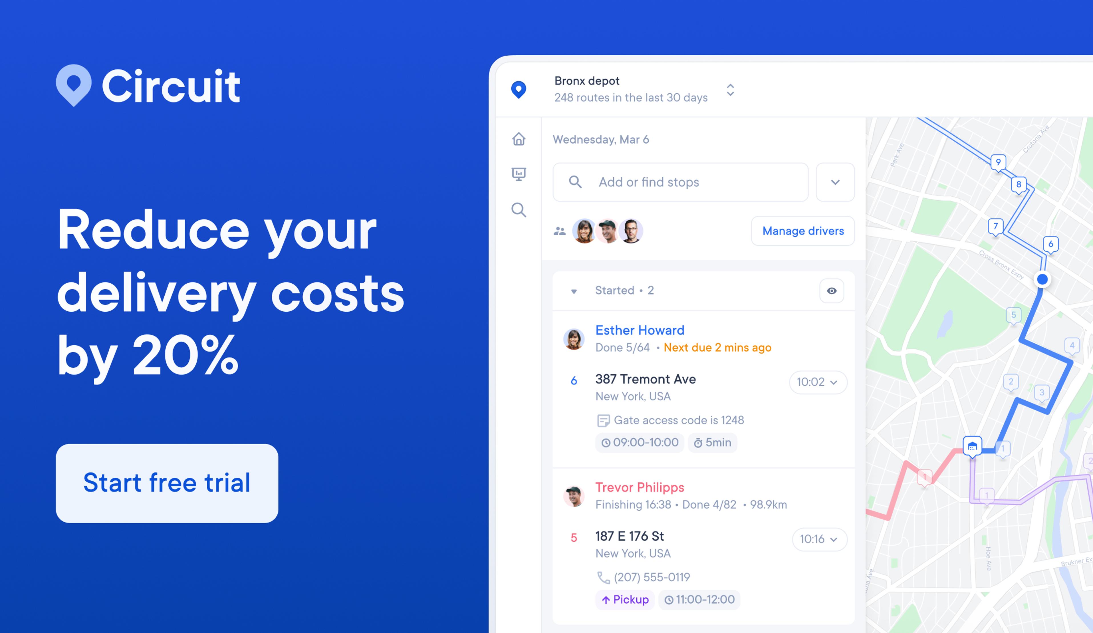
Circuit for Teams

Circuit for Teams stands out as a robust solution specifically designed to address the complex needs of delivery teams, offering features that go beyond the capabilities of Google Maps in several key areas.
Features of Circuit for Teams
- Optimized route planning. Circuit for Teams excels in creating the most efficient routes for multiple stops. This is particularly beneficial for delivery teams who make numerous deliveries.
- Real-time tracking. The app has real-time tracking of deliveries and drivers so dispatchers and customers stay updated on the status of their deliveries. This level of transparency is not available in Google Maps.
- Dynamic rerouting. Unlike Google Maps, Circuit for Teams can dynamically adjust routes on the fly. If a driver encounters an unexpected roadblock or delay, the app instantly recalculates the best possible route.
- Time windows and priority deliveries. With Circuit for Teams, users can set specific time windows for deliveries and prioritize certain stops, verifying critical deliveries are made on time.
- Proof of delivery. The app captures proof of delivery, such as signatures and photos, which is a crucial feature for delivery businesses that’s not available in Google Maps.
Benefits over Google Maps
- Tailored for delivery teams. While Google Maps is a general navigation tool, Circuit for Teams is specifically designed for the needs of delivery teams, providing more relevant features for efficient delivery management.
- Enhanced efficiency. The optimized routing saves time and fuel, making delivery processes more efficient compared to using standard routes on Google Maps.
- Improved customer satisfaction. Real-time tracking and accurate ETAs update the delivery status and enhance customer satisfaction.
- Ease of use. Circuit for Teams offers an intuitive interface, making it easy for teams to manage and track deliveries without the need for extensive training.
- Integration capabilities. The app integrates with other delivery tools and systems for a seamless workflow.
In summary, Circuit for Teams offers a comprehensive suite of features specifically designed for delivery teams, making it a more suitable choice over Google Maps for businesses focused on delivery efficiency and customer service.
Waze

Waze is a widely-used navigation app with a unique approach to travel and routing by leveraging a community-driven platform. While it shares some common features with Google Maps, Waze has distinct benefits and functionalities.
Features of Waze
- Community-driven updates. Waze’s most distinctive feature is its reliance on user-generated content. Users report real-time traffic conditions, road hazards, police presence, and accidents.
- Real-time traffic alerts. The app excels in real-time traffic updates that help drivers avoid traffic jams and delays, which is crucial for timely arrivals.
- Route customization. Waze offers route customization options, allowing users to avoid tolls, highways, or certain types of roads, though these are not specifically tailored for trucks.
- Speed limit alerts. Waze notifies drivers of the current speed limit and alerts them if they are exceeding it, enhancing safety on the road.
- Social integration. Users can share their ETA and route with contacts, which can be beneficial for coordinating with teams or clients.
Benefits over Google Maps
- Up-to-the-minute information. The community-driven aspect of Waze makes sure the information is incredibly current, which can be more up-to-date than Google Maps.
- Avoidance of traffic jams. Waze's real-time traffic updates are particularly effective in helping drivers avoid congestion and find the quickest routes, potentially saving time for those on tight schedules.
- User interaction and engagement. The interactive platform of Waze creates a dynamic and engaging navigation experience.
- Customization and alerts. While Google Maps also offers traffic updates and speed limit information, Waze’s user-friendly interface and customization options create a more personalized navigation experience.
However, it's important to note that Waze, like Google Maps, is not specifically designed for truck navigation. It lacks truck-specific features such as height and weight restriction alerts, which are critical for truck drivers.
While Waze offers many advantages for general navigation and avoiding traffic, truck drivers might need to supplement it with other tools or apps for comprehensive truck-specific navigation.
Trucker Path

Trucker Path is an app dedicated to the unique needs of truckers, offering a suite of features specifically designed for those in the trucking industry. This specialization gives it a distinct edge over more generalized navigation tools like Google Maps.
Features of Trucker Path
- Truck-specific GPS navigation. Trucker Path creates routes tailored for trucks, taking into account truck restrictions such as bridge heights, weight limits, and truck-prohibited roads.
- Truck stop information. The app offers detailed information about truck stops, including available amenities, fuel prices, and parking availability, which is crucial for long-haul truckers.
- Weigh station status. Users get real-time updates on weigh station statuses, helping drivers plan their stops more efficiently.
- Load board. Unique to Trucker Path, this feature connects drivers with available loads, aiding in the logistics aspect of trucking.
- Community feedback. Similar to Waze, Trucker Path has a strong community aspect, with users providing updates and reviews on truck stops, weigh stations, and parking areas.
Benefits over Google Maps
- Customized for truckers. Unlike Google Maps, Trucker Path is designed specifically for truckers and gives information relevant to large commercial vehicles.
- Comprehensive truck stop information. The detailed truck stop information helps drivers plan their breaks and refueling stops, which is not a feature offered by Google Maps.
- Real-time weigh station updates. This feature can save significant time and hassle for truck drivers, helping in planning their routes more effectively.
- Load matching. For independent truckers or those looking for additional work, the Load Board feature adds an extra dimension of utility.
- Community insights. The app's community-driven approach gives insights and recommendations from fellow truckers, which can be more tailored and relevant than the general information on Google Maps.
Trucker Path offers a range of truck-specific features that address the particular needs of truck drivers, making it a more suitable navigation and logistics tool for those in the trucking industry compared to Google Maps.
Sygic

Sygic is a GPS navigation app offering a specialized version for truck drivers with features tailored to the needs of large vehicle navigation. Its focus on commercial driving makes it a compelling alternative to Google Maps for truckers.
Features of Sygic
- Truck-specific routing. Sygic's truck GPS navigation considers vehicle size, weight, cargo type, and road restrictions, offering safe and legal routes for trucks.
- Offline maps. The app allows for downloading maps for offline use, giving access to navigation even in areas with poor cellular reception.
- Dynamic lane guidance. This feature assists drivers make safe lane changes and navigate complex intersections, which is particularly useful for large vehicles.
- Parking and points of interest. Sygic includes detailed information on truck-specific points of interest, including parking spots, fuel stations, and rest areas suitable for trucks.
- Traffic and speed camera alerts. The app gives real-time traffic updates and alerts for speed cameras, aiding in safe and efficient driving.
Benefits over Google Maps
- Tailored truck routes. Sygic’s focus on truck-specific routing is a significant advantage over Google Maps, which is designed for general navigation and lacks truck-specific route planning.
- Offline navigation capability. The ability to use maps offline is a crucial feature for truck drivers who often travel in areas with spotty cellular coverage, a feature not available in Google Maps.
- Detailed lane guidance. For truck drivers navigating complex roadways and interchanges, Sygic’s dynamic lane guidance can be a crucial tool for safe driving.
- Truck-centric points of interest. The comprehensive information on truck-friendly amenities makes route planning more efficient for truckers as opposed to the general information on Google Maps.
- Traffic and safety alerts. While Google Maps offers traffic updates, Sygic’s added focus on speed camera alerts can help truck drivers avoid tickets and drive more safely.
Sygic offers a range of features specifically designed for truck drivers, making it a more suitable choice for those who require detailed, truck-specific navigation and route planning capabilities compared to the more general approach of Google Maps.
Practical considerations for truckers
Efficient route optimization and the right GPS app are crucial for successful long-haul and commercial trucking.
Route optimization is key, especially for long-haul trucking. It involves planning the most efficient paths, considering truck-specific restrictions, fuel efficiency, delivery timings, and regulatory compliance.
Effective optimization enhances time and cost savings, reduces vehicle wear, and improves safety and driver satisfaction.
Truck GPS apps are available on Android, iOS, and iPhone. Key aspects to consider include:
- Platform compatibility. Confirm the app works seamlessly on the intended device (Android/iOS).
- User interface. Look for an intuitive and easy-to-navigate interface.
- Feature availability. Check for any platform-specific features or limitations.
Choosing a navigation app: key factors
- Pricing. Balance cost-effectiveness with required features.
- Ease of use. Prioritize user-friendly interfaces.
- Truck-specific features. Truck-specific information confirms route accuracy and compliance.
- Real-time updates. Accurate information is crucial for traffic and road condition awareness.
- Offline access. Offline capabilities are important in areas with poor network coverage.
- Customer support and updates. Prioritize regular software updates and reliable support.
- Integration with other tools. Integration creates streamlined logistics operations.
Selecting the right app requires balancing functionality, cost, and specific trucking needs for efficient and safe navigation.
Choosing the right tools for truckers
While Google Maps is effective for general navigation, its limitations for truck-specific routing, such as a lack of truck-specific route guidance and parking information, make it less suitable for professional trucking.
For truckers, the right navigation tool is crucial for efficient and safe routing. It should offer detailed route planning, real-time updates, and comply with truck-specific regulations.
Circuit for Teams addresses the unique needs of truck routing with features like efficient route optimization, real-time tracking, and delivery management. Its user-friendly interface makes it a practical choice for truck drivers and dispatchers.
For those in trucking and delivery, Circuit for Teams offers a specialized, efficient solution. Discover the benefits of tailored route planning and optimization with Circuit by signing up at Circuit for Teams.


